


Community Impact Statements (CIS)
Levelock - Community Impact Statement
NOAA Coastal Habitat Restoration and Resilience Grant for an Alaskan Native Community.
Levelock Village Council (the Council) is the governing body of the Native Village of Levelock
(Levelock), a federally recognized sovereign nation and Alaska Native Village. This NOAA grant was to support resilience against volatile shoreline erosion and impacts from climate change.

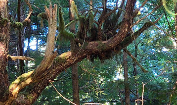
Kvichak River Erosion
By overlaying the imagery we gathered onto existing map imagery, we can showcase an immediate, up to date visualization of the changes happening. This method helps visualize the impacts in an easier to grasp way.


Integrated Community Adaptation & Risk Impact Statements (ICARIS)
NASA / Ketchikan - ICARIS
TBEC is partnering with NASA and the Ketchikan Indian Community (KIC), an Alaska Native Village and federally recognized sovereign nation, to conduct a Community Impact Statement (CIS) to assess climate impacts on Southeast Alaska region and co-develop a tailored and robust Integrated Community Adaptation & Resilience Impact Statement (ICARIS).
National Science Foundation (NSF SBIR Phase I)
National Science Foundation, Small Business Innovative Research Phase I Grant: The research objective was to develop an initial proof-of-concept method for synthesizing the large amounts of often conflicting climate data into meaningful and actionable data that can be combined with the community needs to identify the projected social, economic, cultural, and environmental risks due to disasters and extreme weather. We developed a prototype design for an innovative, forward-looking Community Impact Statement (CIS).

National Science Foundation (NSF SBIR Phase II)
National Science Foundation, Small Business Innovative Research Phase II Grant:
The Integrated Community Adaptation & Resiliency Impact Statement (ICARIS) builds on a CIS, combining geomatics, geodesign, projected future climates, socioeconomic vulnerabilities, and traditional knowledge to increase community biophysical, environmental, and socioeconomic climate resilience.


Targeted Risk Impact Statements
Yukon Kuskokwim Delta Environmental Risk Assessment
Alaskan Native villages are vulnerable to climate change, experiencing escalating rates of erosion, flooding, and failing infrastructures, with a cumulative cost in the millions of dollars. There is a critical need to develop short and long-term solutions that address the impacts of climate change and support Alaskans residing in environmentally threatened communities.

Cemetery Risk
A comprehensive assessment of coastal erosion risks designed to protect the Tribe's ancestral heritage and modern infrastructure. By examining 12 miles of coastline, the initiative focuses specifically on documenting the locations and conditions of cultural resources and cemeteries in both the current Village and Old Village . This project integrates Indigenous Knowledge and archival research with advanced technology, including drone LiDAR mapping and modles to predict shoreline erosion rates over the next 80 years.

UAV Mapping
We were brought onto a job to help map out a contaminated site. This site was located on tribal land, with extremely limited access for work. TBEC arrived with our drone equipment and mapped out key locations with our multispectral imagery.

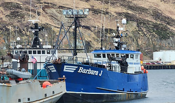
Fish Processing Plant
An assessment was conducted to understand the viability of refurbishing a fish processing plant in Levelock, AK. We were tasked with design work, pricing, and running a feasibility study on the viability of the fishing plant at this location.


Environmental Projects
Blue Mussel Natural Resource Conservation Plan, Pilot Study, and Habitat Suitability Assessment
In Unalaska, the increase in algal blooms due to climate change has been causing blue mussel habitat to decline in quality and increases the instance of Paralytic Shellfish Toxins (PST) in mussels. As blue mussels are an important subsistence food for Unalaskan residents, increasing PST occurrences elevates the risk of Paralytic Shellfish Poisoning (PSP) in community members.

Makah Tribe Broadband Environmental Review and Categorical Exclusion
TBEC was tasked with conducting a National Environmental Policy Act (NEPA) environmental review for this project. Before construction can begin, an environmental review must take place to ensure that project activities will not interfere with the surrounding environment, or if they do, that proper mitigation efforts are taken to ensure minimal disturbance.

Metlakatla Indian Community Invasive Species Management Plan
For the Metlakatla Indian Community (MIC), TBEC assisted with updating of their 10-year Invasive Species Management Plan (ISMP) and the accompanying Environmental Assessment (EA). Collaborating with MIC’s Special Projects team and the Alaska Fish and Wildlife Department TBEC documented current invasive species/noxious weeds nearby the community, as well as identified species of concern in the region that the community may want to start addressing before an infestation occurs.

Hurricane Harvey
The study focused on neighborhoods situated between perpendicular sound walls and nearby rivers, where anomalous flood patterns were observed during the storm. Using hydrological modeling and field data, the research team confirmed that impermeable sound walls increased water elevation by up to 8 inches in homes situated upland from the walls. This artificially redirected water flow toward higher ground and reduced the buffer between homes and the riverbanks.


Data Visualizations
Chugach Climate Impacts Dashboard
This dashboard was created using ArcGIS Experience Builder and includes maps depicting various environmental variables. These include climate data, water data, and land change data. TBEC gathered algal bloom data, stream gauge data, hardiness zone data, landslide data, among others, to include in this dashboard. Climate data (precipitation, wind speed, temperature, and snowfall) were also gathered, and then processed to show changes in these variables from 1960 through the end of the century. Maps of these variables allow users to see clearly how their area is affected, or will be affected, by different environmental hazards.
External Links:

Generational Change in the Chugach
The story map, titled “Generations of Change”, follows Lily, a 10-year-old living in Seward, the generations that preceded her, and the generations that will follow to analyze how climate change has and will impact Chugach communities. For each climatic variable, maps are shown depicting how each generation experienced the variable. The 1980s represent Lily’s grandparents and show what world they grew up in compared to Lily in the 2020’s and what Lily’s grandchildren will experience in the 2080’s.
External Links:


Grant Management
DOI WaterSMART Program
TBEC was hired to aid in the preparation of the WaterSMART grant application. TBEC employees conducted a meeting with North Pole representatives to get the information needed to draft the grant proposal, attended a webinar, and conducted additional research to support the application.

USFWS Tribal Wildlife Grant
The US Fish and Wildlife Service’s Tribal Wildlife Grant provides financial assistance to Tribes for conservation projects. Funds are awarded only to Tribal communities for projects that benefit fish and wildlife and their habitats. This includes subsistence species, as well as species of cultural importance to Tribal communities that are not harvested.

DOT Promoting Operations for Transformative, Efficient, and Cost-Saving Transportation (PROTECT) Program
The PROTECT Program was started under the Bipartisan Infrastructure Law to help communities prepare their surface infrastructure for future natural hazard, such as flooding or extreme weather events. PROTECT grant activities can be grouped into 1 of 4 categories: (1) Planning, (2) Resilience Improvement, (3) Community Resilience and Evacuation Routes, and (4) At-risk coastal Infrastructure.

DOT Better Utilizing Investments to Leverage Development (BUILD)
TBEC helped the QTU prepare a RAISE (now known as BUILD) grant application for funds to construct a new dock in Iliuliuk Bay, Dutch Harbor and additional upland area to increase terminal capacity at this site. This would allow the terminal to accommodate both barge operations and ocean-going vessels at the same time, increasing efficiency, reliability, and safety of operations at the Dutch harbor terminal.
USFWS Zoonotic Disease Initiative (ZDI)
TBEC conducted client meetings to get a sense of what the community wanted to achieve with any funds received from the ZDI. TBEC also gathered additional information to further support the proposal, including information about Avian Flu and subsistence use trends in Unalaska. In addition to the proposal drafting, TBEC also completed necessary forms to be turned in alongside the proposal, and created a budget narrative that clearly showcases how much funds were being requested and where the funds would be applied over the course of the project.
